El Niño could keep Texas flooding in the conversation this fall
See how El Niño shifts Texas' storm tracks, and why Gulf warmth and wet ground could keep flooding a threat through fall.

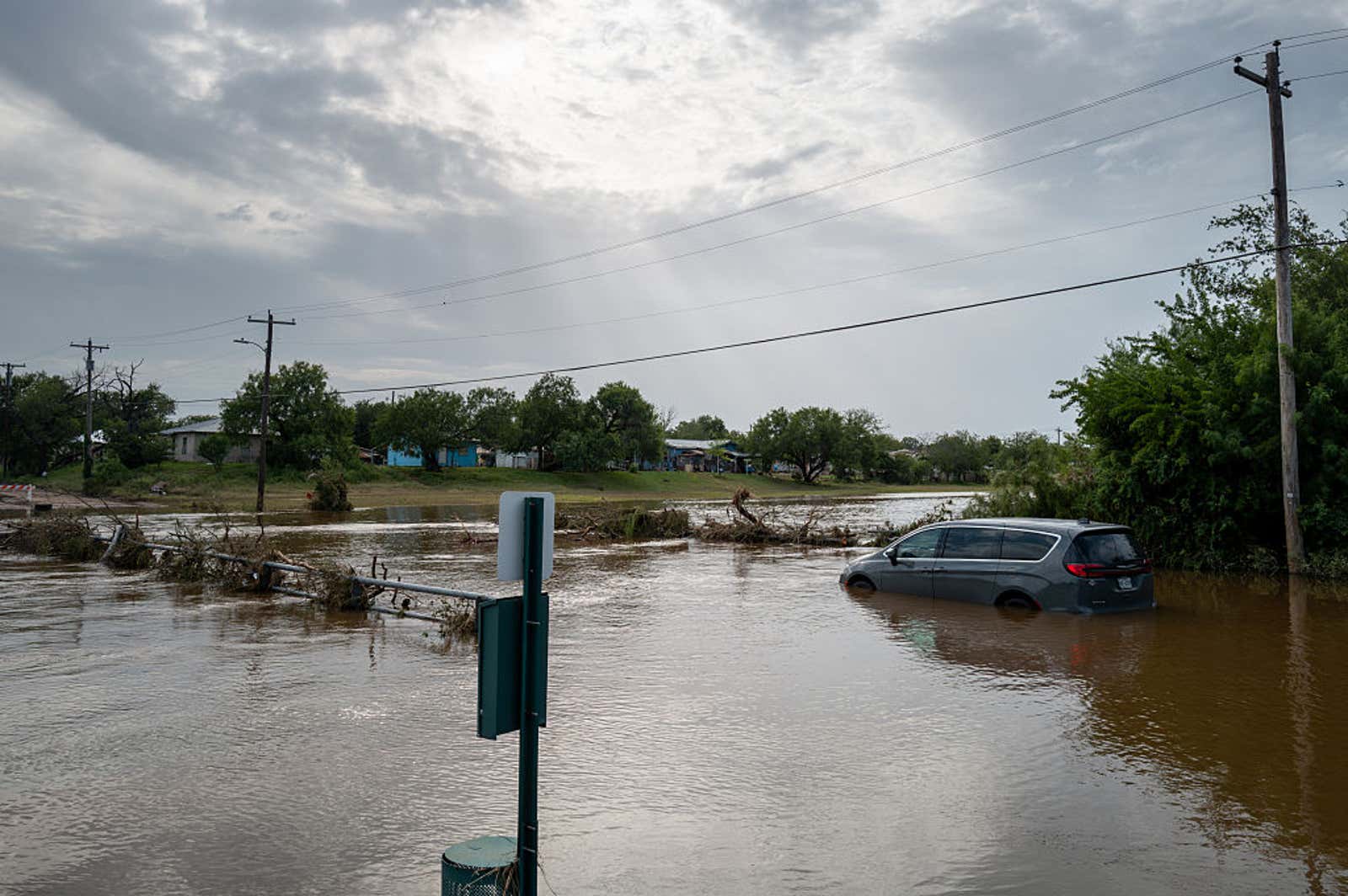
Flash floods swept across parts of Central Texas, bringing torrential rainfall, prompting evacuations, and triggering hundreds of water rescues.
(Brandon Bell/Getty Images)
Fall is moving in, but rain in Texas hasn't gotten the message. The wet pattern that soaked the state all summer hasn't broken — El Niño has been reshaping the storm track for months, and the ingredients for heavy rain are still in play as the season turns.
(MORE: A meteorologist's tips to prepare for and survive a flood)
El Niño has been steering the storm track
It started thousands of miles away in the tropical Pacific, where El Niño has spent the summer changing the larger weather pattern.
One of the biggest changes has been to the subtropical jet stream. As El Niño strengthened, this highway for storms grew stronger and more active across the southern U.S. — giving Texas more chances for rain all season, and keeping that door open as fall arrives.
That doesn't mean every day will be a washout. It means the pattern has favored, and continues to favor, more storm systems moving through the region as we head deeper into fall. The map below shows that trend building toward winter, with the subtropical jet's southern track running directly over Texas.
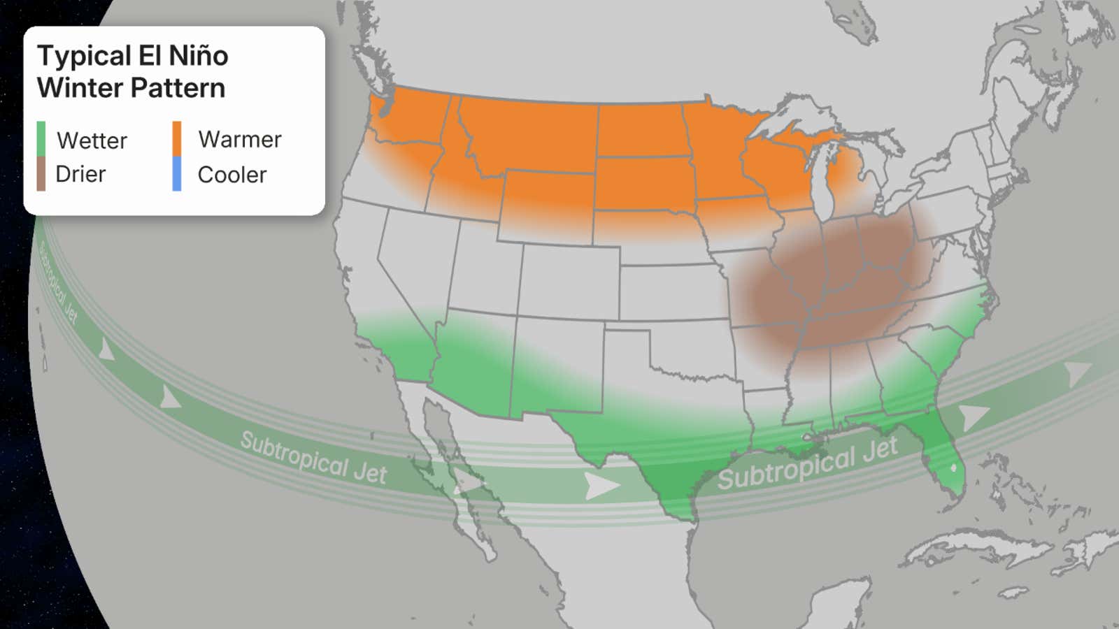
This map shows the typical winter pattern over the U.S. and Canada during an El Niño.
(NOAA)
Warmth has been fueling the rain
Once storms reached Texas this summer, they found a major source of heat and moisture sitting right next door — and that hasn't changed.
Get More of Our News on Google
Set The Weather Company as a 'Preferred Source' to get quicker access to the news you value.

The western Gulf has stayed unusually warm, and it's on pace to stay that way into fall, giving thunderstorms and tropical disturbances plenty of moisture to work with. Because some systems can develop close to the Texas coast, there may not always be much time between a storm forming and its impacts reaching communities.
El Niño set up the southern storm track; the warm Gulf supplied the moisture. Together, they turned that setup into a summer of rainmakers — and neither piece has backed off yet.
(MORE: What does a 100-year flood actually mean? It's not what you think.)
Wet ground keeps the storms alive
The flooding threat doesn't necessarily end once a tropical system moves over land, either.
Tropical systems usually weaken after losing the warm ocean water that fuels them. But months of rain have left Texas soil exceptionally saturated — wet enough to keep supplying heat and moisture on its own, slowing that weakening process. It's known as the brown ocean effect.
Even a storm that weakens into a depression or remnant can still carry plenty of moisture inland, producing heavy rain long after landfall.
(MORE: Potentially historic super El Niño: What does it mean for your weather?)
The pattern isn't resetting
None of this guarantees a repeat of summer's heaviest rain. But the mechanisms behind it — the jet stream, the warm Gulf, the saturated ground — haven't shut off just because the calendar turned. For Texas, that means the flood risk carries into fall rather than closing out with summer.
Faiza Mohammed is a meteorologist intern at weather.com. She studied geography and worked with the Weather Dawgs team at the University of Georgia. She also received her master's in Earth and Atmospheric Sciences from the Georgia Institute of Technology.
Loading comments...